TDPC RO product distribution map. Showing atmospheric/ionospheric profile global distribution. Clicking each point will display it's profile figure and information
RO information:
Penetration Depth: Lowest height.
Occ. azimuth: Azimuth angle of the occultation plane at tangent point with respect North direction, positive to the East from the North direction.
Occ. type: LEO satellite close to GNSS is rising. Another way is setting
Example :
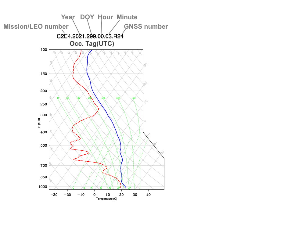
![]()
Lat.=
deg., Lon.=
deg.
Penetration Depth:
km
Occ. azimuth:
deg
Occ. type:
setting
Download link:
Max ED : Maximum electron density
Lat./Lon.: Latitude/Longitude at maximum electron density
Occ. type: LEO satellite close to GNSS is rising. Another way is setting
Example :
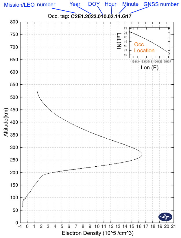
![]()
Max ED:
*10^5 el/cm3
Lat.=
deg., Lon.=
deg.
Occ. local time hour=
Occ. type:
setting
Download link :